geographic trip
tom guter,tamir zohar ,
shir lauterbach,
maya friedlander toubi


jorden river נהר הירדן
נהר הירדן הוא נהר העובר בשבר הסורי אפריקאי, זהו שבר המתחיל בסוריה ונגמר באפריקה ומכאן שמו. נהר הירדן הוא הנהר הגדול ביותר והיחיד במדינת ישראל. אורכו של נהר הירדן הוא 105 ק"מ בקו אווירי אך מכיוון שזה נהר שמתפתל ולא בקו ישר אורכו הוא פי שניים כלומר 210 ק"מ שהם 130 מיילים. מסלולו של נהר הירדן מתחיל אי שם בצפון הארץ בהר החרמון- השלגים המצטברים בחורף נמסים לשלושה נחלים עיקריים:
1. נחל חרמון( בניאס ), שמקורו למרגלות הר החרמון.
2. נחל דן, הנובע למרגלות תל דן.
3. נחל שניר( חצבני ), הארוך מכל היובלים.
The Jordan River is a river that passing in the surrian affrikan Rift , It's a fragment that begins in afrika and ends in Soria and that is the menning of the name of the rift coming. The Jordan River is the largest river and the only one in Israel. The lenght of the Jordan River is 105 kilometers but because it is a winding river and not a straight line it's length is twice longer, that is 210 km or 130 miles. The Jordan River begins in the north in Mount Hermon. winter snows melt into three main streams:
1. the Hermon river (Banias), from the foot of Mount Hermon.
2. the Dan River resulting from the foot of Tel Dan.
3. the Snir river (Hasbani), the longest of all the streams.
.
Ein Gev עין גב
צימר זה ממוקם על הגדה המזרחית של הכנרת, בקרבה לרמת הגולן ולאטרקציות ההרפתקניות הנמצאות שם.
אתר הנופש עין גב מוקף במדשאות ירוקות ומציע חדרים ובונגלוס פרטיים עם מתקני ברביקיו.
המלון, הכולל חוף פרטי משלו, שוכן באזור יפהפה, ויהווה מיקום מושלם לבילוי חופשה מרגיעה. העיירה טבח'ה, שהינה אתר נוצרי חשוב, נמצאת
במרחק של 25 ק"מ משם בלבד.
this zimmer is placed on the eastern shore of the sea of galilee, near to the Golan Heights and to the adventurous Attractions that placed there. Ein Gev resort Surrounded by greens lawns and Suggest rooms and private bungalows with BBQ. the hotel, that includes his own private sea beach, is placed in a beautiful area, And will be a perfect place to spend a relaxing holiday.
the town tabaha which is an important christian site, placed just about 25 kilometer from there.
pole river נחל עמוד
I'רמת קושי : רגיל עד בינוני אורך : כ 18 קמ מחניון פיתול אטרקציות: עין יקים עמוד. דמי כניסה : 18 שח לחניון עונה מומלצת :אביב נחל עמוד הוא נחל באזור בגליל הנשפך אל הכנרת, הנחל נמצא ברמת דלתון בגובה 800 מטר מעל פני הים, הנחל מגיע בסופו לנחל מירון. דרכו של הנחל : זורם דרומה דרך הגליל המזרחי עד לצפון מערב הכנרת ומגיע לגובה של פחות מ200 מטר מתחת לפני הים. הנחל נקרא כך על שם סלע גבוה הנמצא בקרבת אחד מאפיקיו של הנחל שנמצא ליד קיבוץ חוקוק. הסלע מזכיר בצורתו עמוד גבוה ומכאן מגיע שמו - נחל עמוד.
Difficulty : normal to medium . long : 18 km from parking Torsion. Attractions: ein yakim pole. Admission fee: 18 shekel for parking.
Recommended Season: Spring. pole river it's a river in the upper galilee who Spills into the sea of galilee, the river is in ramat dalton in height of 800 meter. the river comes in his end to meiron river. way of the river: the river flows south through the eastern galilee till the north- west side of the sea of galilee and comes to lower height of 200 meters under the sea.
the river name called like this because of a very high rock that placed next to one of the river channels that placed near grouping Hokuk. the rock is reminding in his shape a tall pole and from this comes his name- pole river.

The first Court Museum - Degania A מוזיאון חצר הראשונים -דגניה 'א
בלב קיבוץ דגניה א' שוכנת "חצר הראשונים" - מרחב אותנטי שנראה כאילו נלקח מראשית המאה שעברה. כאן, במקום שבו פעל חדר האוכל הראשון של הקיבוץ, שוכן כיום מוזיאון לתולדות דגניה. הסקירה המרתקת עשירה למדי וכוללת צילומים, מסמכים, מכתבים, מפות, דגמים, כתובות ומוצגים שונים - הכל נועד כדי להעמיק את הידע באשר לדגניה, הנחשבת "אם הקבוצות". מוצעים פה גם הסברים מאירי עיניים על חיי הקבוצה מבחינה רעיונית, וכן מוצגות הדמויות שפעלו, חיו והשפיעו על דרכה: מרופין, דרך גורדון, טרומפלדור, ועד רחל המשוררת ורבים אחרים - אנשים שביקשו ליצור חברה חדשה שבבסיסה שוויון ושיתוף, חיי עבודה, יצירה ואחריות הדדית.
in the Heart of Kibbut's Degania Alef is the "Pioneers court" - an authentic space that looks as if taken from the beginning of the last century. Here, where the dining room first worked on the kibbutz, is now a museum of the History of Degania. A fascinating and rich review that includes photographs, documents, letters, maps, models, addresses and various exhibits - all designed to deepen the knowledge about Degania, considered "Mother of the groups." Featured here explanations illuminating the lives of the group, conceptually, and presented the characters that worked, lived and influenced its History: from Rupin through Gordon, Trumpeldor, and poet Rachel and many others - people who wanted to create a new society which is based on equality and cooperation, work life, work and mutual responsibility .
מסעדת הדגים עין גב
Ein Gev fish Resturant
ענף הדייג בעין גב הוא גאוות הקיבוץ. בסיור על המזח בשעות הבוקר המוקדמות או בשעות אחר הצהריים תוכלו לצפות בדייגים של עין גב חוזרים עם שללם בספינות הכבדות, המצויידות ברשתות דייג גדולות, לצד סירות הדייג ורחש הגלים - ניתן לדמות את החיים של פעם סביב האגם הזה.
כבר בימים קדומים של אזור בקעת הכנרת- הוקמו סביב האגם- כפרי דייגים, ורוב פרנסת הכפרים והערים הגדולות שקמו לאורך ההיסטוריה - סבבו את עולם הדייג והאגם. ההיסטוריון הרומי, סטראבו, העיד כי בתקופת המאה הראשונה לסה"נ, סיפקה הכנרת את הדגים הטובים ביותר .
The fishing industry is the pride of Ein Gev kibbutz. A Tour on the dock in the early morning or in the afternoon you can watch the fishermen of Ein-Gev return with their catch the heavy ships, equipped with large fishing nets, fishing boats alongside and sound waves - One can imagine the life of the time around this lake.
Already in ancient times the lake Kineret valley area - built around the lake - fishing villages, and most of the livelihood of the villages and cities were established throughout history - based on fishing in the lake. Roman historian, Strabo, testified that during the first century AD, that lake Kineret has provided the best fish.
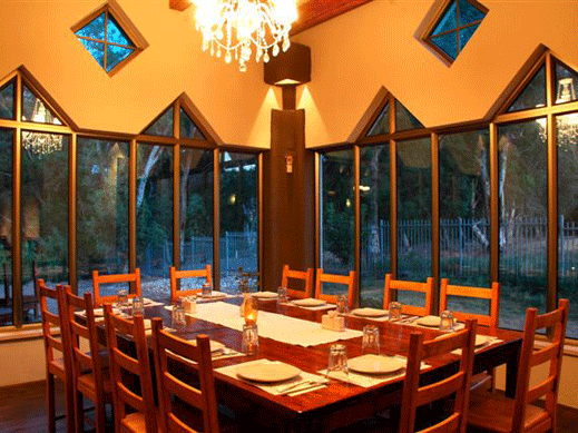
מסעדת איסקנדר eskander resturant
מסעדה השוכנת על גדות נהר הירדן כאשר מסביבה נוף פסטורלי מרגש ומיוחד. מסעדת איסקנדר היא ממסעדות הבשר הטובות בצפון. מסעדת איסקנדר מתמחה בבישולי קדירות, נזידים ומאפי בשר מעולים. תפריט המסעדה כולל מגוון מאכלים ים תיכוניים הכוללים שלל דגים. מלבד לאוכל הטעים והערב המוגש באיסקנדר, ארוחה במסעדת איסקנדר כוללת הנאה מהנוף המרהיב של צפון רמת הגולן והר החרמון וכמובן האזנה לצליל היפה ביותר שמפיק הטבע הצפוני, צליל זרימת מי נהר הירדן. ומה יותר טוב מאשר שילוב של אוכל מעולה, נוף מרטיט ומוזיקה טובה, יש גם ארוחות ילדים אם מטיילים
במשפחות.
the Restaurant located on the banks of the Jordan River with scenic surroundings exciting and special. Iskander Restaurant is the best meat restaurants in the north. Iskander restaurant specializes in cooking casseroles, stews and meat pastries excellent. The menu includes a variety of Mediterranean dishes with a variety of fish. Besides the delicious food the evening, Iskander restaurant meal includes pleasure spectacular view of the northern Golan Heights and Mount Hermon and of course listening to the most beautiful sound produced by northern nature, a sound flow of the Jordan River. And what better than a combination of excellent food, thrilling scenery and good music, there are also children's meals for traveling families.

קיבוץ עין גב kibbutz ein gev
צוק מנרה שבמרכזו הרכבל הארוך ביותר
בישראל מציעה חוויה חד פעמית ובלתי
נשכחת של נופים קסומים ושלל צבעים.
הרכבל מטפס ממבואותיה הדרומיים
של קריית שמונה ועד לקיבוץ מנרה
במרומי רכס נפתלי. 12 הקרוניות עולות
ויורדות בעת ובעונה אחת לגובה 742 מ`
ולאורך של 1740 מ`. הנסיעה ברכבל
מתאימה לכול הגילאים.
Manara Cliff centered on the longest cable car
in Israel offers an experience of a lifetime and you will not Forgot the beautiful landscapes and a variety of colors.
the Funicular climbs on the southern outskirts
Kiryat Shmona to Kibbutz Manara
to Naftali ridge top. there is 12 trolleys they ride up
And down at the same time from a height of 742 '
And a length of 1740 m '. the Cable car ride
Suitable for all ages.
קיבוץ על חופה המזרחי של הכנרת. השם "עין-גב" מתייחס למילה "נקבה" או "נוקייב" על שם הכפר הערבי א־נוקייב.
הקיבוץ נוסד בשנת 1937 במסגרת ישובי "חומה ומגדל".
במלחמת העצמאות הותקף הקיבוץ על ידי הסורים. חברי עין-גב הדפו את התקפות הצבא הסורי שנעזר בתותחים ומטוס להפגזה, במשך שלשה ימים, עד שנסוג. הקבוץ מילא את משימתו - שמירה על כל הכנרת בתחומי מדינת-ישראל. התנכלות הסורים נמשכה גם לאחר הקמת המדינה עד למלחמת ששת הימים.
בעקבות יישום הסכמי שביתת הנשק בין ישראל לסוריה ב-1949 ("הסכמי רודוס") נקלע הקיבוץ לתוך מובלעת בין שני אזורים מפורזים שהריבונות עליהם לא הייתה ברורה. ישראל פעלה למימוש ריבונותה בכל השטח עד הגבול הבינלאומי ואילו סוריה ניסתה לחלוש על השטחים הסמוכים לגבול ממערב באמצעות ירי והתקפות צבאיות. תושבי עין גב סבלו מאוד מההתקפות האלה שלא נסתיימו עד לאחר כיבוש רמת הגולן בידי צה"ל במלחמת ששת הימים. הקיבוץ מתפרנס מחקלאות (כולל דיג)
ומתיירות ומונה כ90 משפחות.
Grouping the eastern coast of the Sea of Galilee. the name ein gev" refers to the word "nikba " or "Nokiib" the name of the Arab village of al - Nokiib.
The kibbutz was founded in 1937 as part of the communities "Wall and Tower".
in the War of Independence, the kibbutz was attacked by the Syrians. Members of an eye - Ms. repulsed the attacks of the Syrian army aided by artillery and aircraft bombardment, for three days, then backed away. the Kibbutz fulfilled his mission - keeping all of Galilee in Israel. the Syrian harassment continued even after the establishment of Israel until the Six Day War.
Following the implementation of the armistice agreements between Israel and Syria in 1949 ("Rhodes agreements") caught grouping into an enclave between two demilitarized zones sovereignty them was not clear. Israel acted exercised sovereignty over all territory to the international border and Syria tried to dominate the areas adjacent to the border to the west by shootings and assaults. Residents of Ein Gev suffered greatly these attacks not ended until after the occupation of the Golan Heights by the IDF during the Six Day War. Kibbutz living from agriculture (including fishing) and tourism and has about 90 families
מרינדו-נמל עין גב marindo- ein gev port
טיילת ציורית על שפת הכנרת הצופה אל נמל עין גב ואל נופי הגליל והגולן
פעילות ימית של אירועים והפלגות על המים: שייט כנרת, שייט דייג ודייג ליום אחד.
סדנאות יצירה בעץ להורים וילדים בנגרייה של סבא יוסי.
"דרך הקיבוץ"- סיור רכבת ברחבי הקיבוץ.
חוף רחצה וחנות מתנות בצמוד למסעדת הדגים.
מוזיאון בית העוגנים וגלרייה לאמנות
בסופי שבוע, בחגים ובמועדים, ישנם אירועים
נוספים לקהל הרחב
Picturesque promenade overlooking the Sea of Galilee to the port of Ein Gev and landscapes of Galilee and the Golan
Marine activity and Sailing events on the water:sailling in the kinneret , sailing and fishing fishing.
Wood craft workshops for parents and children of Grandfather Joseph carpentry.
"Through the Kibbutz" - a train tour of the kibbutz.
Beach and a gift shop adjacent to the fish house.
ognim museum and Art Gallery
On weekends, on holidays, there are other events for the public.
צוק מנרה cliff manara
הכנרת the kinneret
ימה בארץ כינרות. זהו האגם הגדול ביותר
בארץ ישראל אשר מכיל מים מתוקים. הכנרת מספקת כ-25% מצריכת המים בישראל ומהווה את
.אחד ממקורות מי השתייה וההשקיה העיקריים
רומה של הכנרת מצוי בטווחים של 208.8- עד 214.87- מטר מתחת לפני הים, והיא הימה המתוקה הנמוכה ביותר בעולם. ברום המרבי, שטח פני האגם הוא כ-168 קמ"ר והעומק המרבי כ-44 מ'. הנקודה העמוקה ביותר בקרקעית הכנרת נמצאת ברום של 256- מ' מפני הים[4].
מיקומה הוא על הבקע הסורי-אפריקני, מה שגורם לפערים טופוגרפיים גדולים (כ-550 מטר) בינה לבין השטח שסביבה. הכנרת, כמו ים המלח, היא למעשה תוצר של הבקע, וצורתו המיוחדת הינה למעשה מעוין שהתעגל ברבות הימים בשל בליה של הטבע. (באזור הכנרת הבקע לא היה ישר אלא מזוגזג, והיו בו מדרגות אופקיות, וכאשר חלק אחד ממנו הועתק ממקומו צפונה, נוצר חלל בצורת מעוין).
בשנת גשמים ממוצעת מספקת הכנרת כשליש מצריכת המים בישראל. היקף חופי הכנרת נע בין 55 ל-60 ק"מ לפי גובה המפלס. במפלס הגבוה ביותר שטחה הוא כ-169 קמ"ר ובמפלס הנמוך
ביותר 161 קמ"ר.
sea in the family of Kinrot. It is the largest lake
in Israel which contains fresh water. the Lake provides about 25% of water consumption in Israel and is the
. A source of drinking water and irrigation main
the height of the lake is in the ranges of 208.8-to 214.87-meters below sea level, and it the low sweet lake in the world. The maximum altitude, the lake's surface area is 168 square kilometers and a maximum depth of approximately 44 m. the Deepest point at the bottom of the lake is at an elevation of 256 - m from the sea .
her location is on the Syrian Rift - African, causing large topographic gaps (about 550 meters) between it and the surrounding area.his shape, like the Dead Sea is actually a product of the hernia, and its unique shape is actually a curved eventually because of natural weathering. (Rift lake area was not straight but zigzagged, and had horizontal steps, and when one part of it was moved up north, there is a diamond-shaped space).
the Average rainfall in the lake provides a third of Israel's water consumption. Shores of the lake volume ranged from 55 to 60 km under the water level. Highest level area is approximately 169 square kilometers and a low level
The 161 square kilometers


על המקומות בהם נטייל about the places we will travel